Martene Rourke & Adam Heiss

© Martene Rourke

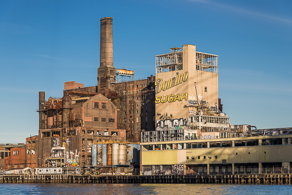
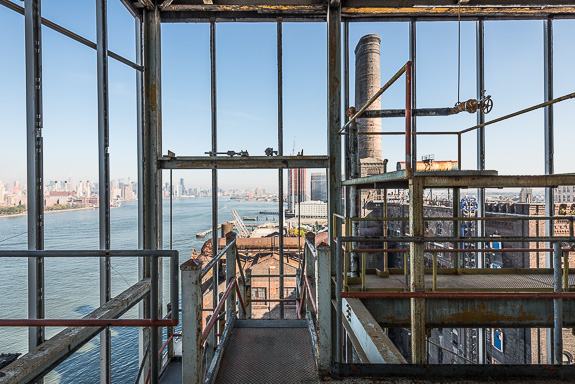
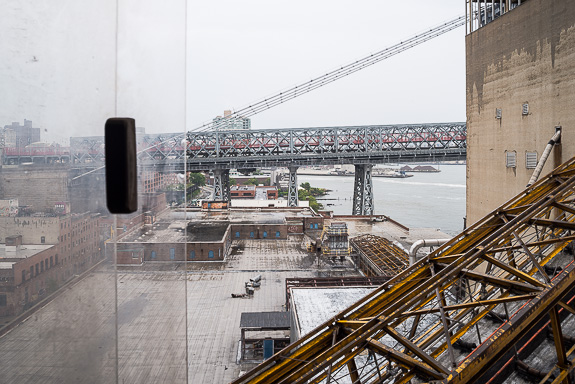
www.AdamAndMartenePhotography.com

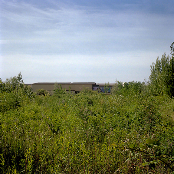
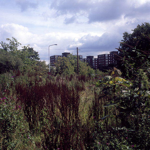
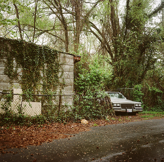
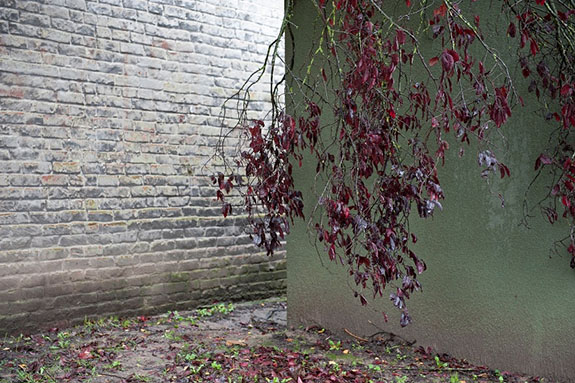
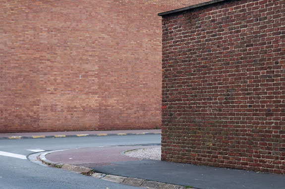
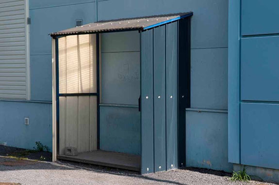
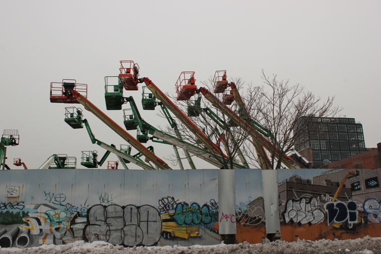
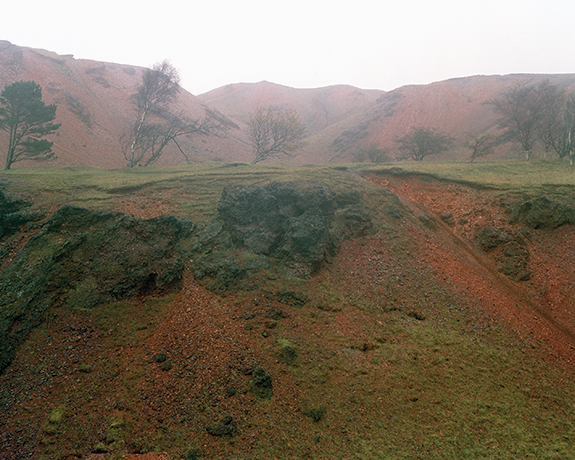
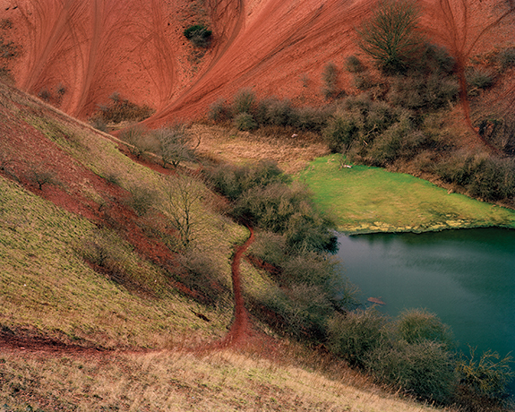
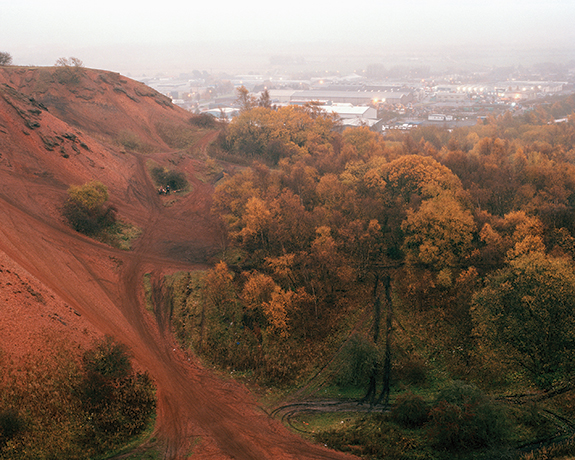
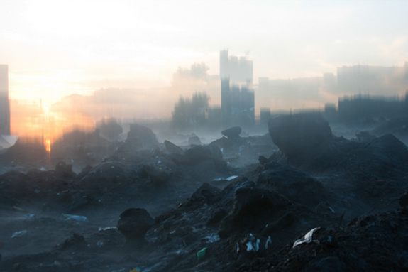
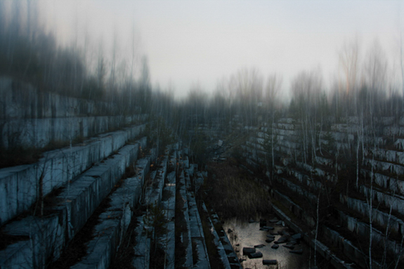
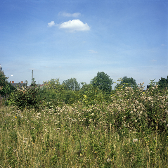
The series Urban Wilderness depicts areas of land within various European cities which have been left unused for a period of time, where subsequently nature has been left to its own devices. These spaces lie in an intermediate state as land is bought and sold, decisions are made and plans are drawn. In some cases these spaces have been left for so long they appear to have been forgotten.

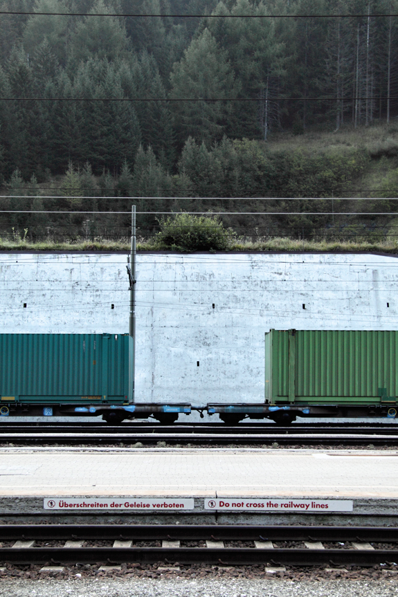
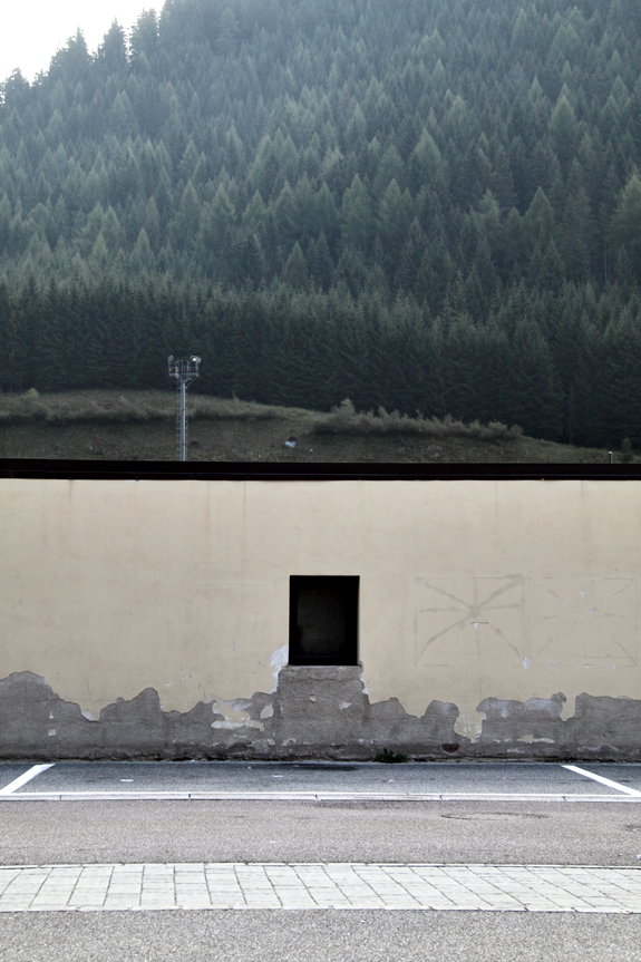
Spaces such as these are mostly closed off from the general public and often in order to enter it is necessary to overcome physical obstacles such as walls or fences. These obstacles establish the fact that these spaces are not there for the public to enjoy. They are privately owned pieces of land bought for the purpose of private business development.

These temporary havens of nature which are surrounded by the built environment contrast starkly with the controlled form of nature that we experience within city parks and gardens. They serve as a reminder that nature is always waiting to reclaim space whenever the opportunity arises.

— Martene Rourke & Adam Heiss, Manchester, United Kingdom

© Martene Rourke

© Martene Rourke3

Stephen Voss

© Stephen Voss

www.StephenVoss.com

Federal Limits is a walking survey of the 40+ mile border of Washington, DC, where I live. This border traverses swamps, cemeteries and some of the wealthiest neighborhoods in the country. The invisible line skirts the edges of the National Mall, the only place that a vast majority of visitors to the city will see.  It passes quietly along the water, never quite letting the Capitol come into view, where so much of the nation’s perception of the city derives. Through these images I’m looking for help to piece out my own definition of the city.

— Stephen Voss, Washington, DC, USA

Washington DC border photographs

Washington DC border photographs

Pierre Rogeaux

© Pierre Rogeaux

www.PierreRogeaux.com

I photograph fragments of urban reality in ordinary streets. In these everyday situations, I search for a visual freedom — leaving the choice to spectators to read images at a formal or documentary level.

The studio work is a constant concern in my practice of landscape photography. The walls act as backdrops, the mundane setting of a large studio where I compose urban still lives. 

These stagings of an agreed banality, purified from human activity, are a pretext to my own wandering. The choice of subject is a support and requires no development. This urban walking without exit is loosing us in the public space, transforming the city into a large maze.

– Pierre Rogeaux, Lille, France

© Pierre Rogeaux

© Pierre Rogeaux3

Paul Raphaelson

© Paul Raphaelson

www.PaulRaphaelson.com

Once the biggest sugar refinery in the world, Domino shut down in 2004, after a long struggle. Most Brooklynites of my generation know it as an icon on the landscape, multiplied on t-shirts and skateboard graphics. Urban explorers sly enough to breach the gates have found a playground of sublime, post-industrial texture and nostalgia.

I’ve been attracted for a long time to the iconic and esthetic features of the place. I also realized that if I had the chance to photograph it, I’d want the work to explore something more.

In 2013, the owner of the site, Two Trees, generously agreed to let me in. I had proposed a project that would attempt to look beyond the popular surface of Detroit-style decay photography. My goal was an expansive, even messy, fusion of art, icon, and industrial history. I wanted to show the ruin as its majestic self, and also as a lens through which to explore the history of the place and its people.

In a sense, I found myself looking at a long-gone version of the country, through a recently-gone industry and community, through a soon-to-be gone abandoned factory.

I also found myself working in the abstract, seeing how much chaos could be allowed into the frame, while still making a coherent picture. The visual density and confusion of the place invited this kind formal experiment.

The project will ultimately be a book — I hope a big and beautiful one. I’ll be working with Matthew Postal, an architectural historian who can show the deep connections between Domino, the global sugar trade, and the history of Brooklyn. I’ll also be working with Stella Kramer, a world-class photo editor, and with a group of former refinery employees, who can tell Domino’s real stories.

— Paul Raphaelson, Brooklyn, New York, USA

From the top of the bin structure.

Conveyor and foot bridge, from filter house.

Kassandra Mara Lefakinis

© Kassandra Mara Lefakinis

I live in Greece where the natural scenery is pure, breathtaking and inspiring on a daily basis. Here there is also a lack of urban planning, proper disposal system, and general order which leads to a kind of chaos or imposition of random junk against the harmony and continuity in the landscape. A new landscape forms which endlessly appeals to me and my camera lens. The mingling of humans and their created environment, sidelined by nature, and the play between what’s man-made and what’s natural is a theme in my photography wherever I go. It’s almost quirky, seeing how nature takes on characteristics of the man-made and the man-made becomes an integral part of the landscape — eventually these two defined categories meld and create a new language I try to capture visually.

— Kassandra Mara Lefakinis, Athens, Greece

© Kassandra Mara Lefakinis

© Kassandra Mara Lefakinis3

Jack Luke

© Jack Luke

www.JackLuke.co.uk

The bings are an enormous set of spoil-heaps comprised from the tailings of the once globally important shale-oil industry which was centred in West Lothian. Since workings ended in the early 1960’s, the bings have gradually been re-appropriated as an unlikely leisure ground, site of nationally significant biodiversity and a monumental symbol of West Lothian identity.

The unintentionally beautiful, sculpted slopes of the bings are slowly being reclaimed by birch woodland and grassy meadows; in places, almost completely obscuring the industrial origins of the land they lie upon.

The bings are also at the core of the vibrant, central-belt motocross scene. The faces of the tips are relentlessly altered by their tracks with each passing weekend.

The bings are not without their issues and they fall foul of the usual problems associated with derelict land, with fly tipping and anti-social behaviour being the key problems.

Although I describe my project as a study of the bings, it’s perhaps more appropriate to describe the photographs as a record of my experience of them. I eschew the absolute objectivity often associated with contemporary landscape photography in favour of making lyrical images and by doing so aim to challenge ideas about how we perceive use of post-industrial landscapes in Scotland.

— Jack Luke, Edinburgh, Scotland, United Kingdom

Untitled (From the series, The Bings)

Untitled (From the series, The Bings)

Aaron Brumbelow

© Aaron Brumbelow

www.AaronBrumbelow.com

These landscapes are made of polygons, rendered by 3-D artists employed by Blizzard Entertainment and presented to me as pixels on a screen in the online game World of Warcraft. These lands are no less traveled than the physical spaces around us. They hold real memories and evoke powerful emotions to those who have spent time in this digital world. I, like Muybridge and Watkins, am bringing back representations of landscapes most will not have the fortitude to travel in. Unlike the physical spaces around us these digital lands are continually growing, creating new continents to be explored and exploited.

— Aaron Brumbelow, Savannah, Georgia, USA

© Aaron Brumbelow

© Aaron Brumbelow3

Robert Doyle

© Robert Doyle

www.RobertDoylePhotography.virb.com

I photograph the landscape around me, the landscape I see in my day-to-day travels and activities. This includes the picturesque as well as the discarded. These images have been collected into a series of monthly or bi-monthly journals that I have self-published thru Blurb.


The images can be arranged in a few broad categories:  memorials, commercial properties (closed and thriving), intersections (urban and rural), pastoral (urban and rural). When put together they build a portrait of my activity in my environment/community.


It was the closed commercial properties that I started with in 2010. I was driving about 200 miles a day for my job, taking the same route each day for about five months.  One starts to see things after a while that one may not normally see. I would pass through many small towns between Naples and Rochester as well as parts of Rochester, urban and suburban that were vacant, for rent/sale/or lease — evidence of a shift in the economy.


I often use the panorama format because I am interested in the context of the thing/place I am photographing. I do not want to isolate. I want to show where it is and what is around it.


When my job changed, my route became more varied, almost random. Other elements/subjects start to appear. The memorials I am finding very interesting at this point. Some mourn, some celebrate. They are everyplace — sometimes conspicuous sometimes hidden.

In my journals you can see the annual cycle, winter, giving way to spring and summer. Then the very gradual coming of fall before the snows and the sky turns gray. You can also see signs of a multinational corporate presence in our rural areas, industrial farming, an economy that is in a tail-spin. You can see the evidence of national and global conflict and the players in that game as well as occasional signs of hope.

— Robert Doyle, Gainesville, New York, USA

© Robert Doyle

© Robert Doyle3

Yanina Boldyreva

© Yanina Boldyreva

www.YaninaBoldyreva.net

This project shows space surrounding me as the post-apocalyptic world. It has no people or architecture, and only separate ruins which jut out of the ground to indicate the past developments.

I used pieces of plastic as the filter to hide part of the image and to allocate the details necessary to me in a landscape.

I look at the landscape as an astronaut who has visited the planet in years after he abandoned it. Therefore, these works have the personal experiences of the astronaut concerning the myth about the lost past and impossibility to begin new life mixed up with documentary details for his field notes.

The combination of commonness and mysticism creates an empty scene for the spectator’s imagination.

— Yanina Boldyreva, Novosibirsk, Russia

© Yanina Boldyreva

© Yanina Boldyreva3

Doris Doppler

© Doris Doppler

www.DorisDoppler.com

I’m fascinated by the relationship between nature and traffic, especially by tunnels, streets and rail lines leading through the mountains. Although the mountainous region is cold, hostile and sometimes scary, the people always strived to build traffic routes nonetheless.

I’m working and living in Innsbruck, which is located in the middle of the Alps. South of the city there is an important Alpine crossing, the Brenner Pass, the border to Italy.

In former days, the village of Brenner was a popular resting spot for tourists, merchants, and other people travelling to Italy and back. Nowadays, it’s a kind of “lost place,” although Brenner is one of the most important European transit routes. The village — squeezed in between high mountains, the highway and the rail line — is dying. As the border post was closed in 1998, all the customs officials and exchange offices disappeared as well as many hotels and shops.

Brenner is an Alpine bottleneck. It’s dominated by a much-used highway, noise, exhaust gases, and an oversized rail station, surrounded by sheer mountain slopes. It’s a place where irreversible human intrusion turned the Alpine landscape into an ugly spot.

— Doris Doppler, Innsbruck, Austria

© Doris Doppler

© Doris Doppler3