Carlo Massarutto

© Carlo Massarutto

CarloMassarutto.com

The Milan area at the time of the expo.

This project comes from the observation of the towns that are lived only as dormitories. There are spaces created for entertainment and leisure, children’s playground and soccer fields. The absence of users makes these spaces ghostly, vacuum.

During the week, people move to the big city, Milan, emptying the small towns in the hinterland, where space is filled with palaces and buildings that stand out on the fields. The sense of abandonment of certain areas and the neglect of its people gives these places a post-apocalyptic look, where the values of the company are evident and oriented consumerism.

— Carlo Massarutto, Milan, Italy

© Carlo Massarutto

© Carlo Massarutto3

Denis Guzzo

© Denis Guzzo

DenisGuzzo.com

My work researches the Anthropocene, traces and perspectives of our civilization; it encloses the correlation between photography and the built environment and between research and documentary practices. My projects are outlining human geography, environmental and geo-political themes. In human geography, the idea of meaning has been central to the notion of place since the 1970s. More importantly, it finds its roots in the Roman concept of Genius Loci, the spirit of the place, and previously in Aristotle and Plato. I often refer to these ancient notions to investigate the labyrinth of observations that we are used to call geography and history.

Photography is an autonomous language that has given us the power to get to the surface of meanings. Like this text you are reading, photography has the ability to travel space and time as a polyhedral archaeology of human ideas¹. Photographs are not what we see, but they are anything else what we can understand from them. So I like to think that images are some kind of abstract space; a hyper-surface where every act of perception is an act of creation.

My approach focuses primarily on the combination of facts before coming to the composition and other aesthetics. Sometimes I cross the field of visual-audiovisual arts with the use of cartography; but my favorite instrument remains my large format view camera. The amount of research and time that I take to explore and document those places has nothing to do with the rush of today’s consumption of images. This introduces also the ethical question regarding how or why a photograph is being taken, used, presented and how reliable its content is.

My work is avoiding the traditional photo series that act as registration and repetition of a specific subject. Contrarily, and probably also as a result of my mixed background, they are based on a multiplicity of landscape perceptions². I use the bi-dimensional medium of photography to challenge the space through a spatial analysis. This becomes more evident in my exhibitions and installations, characterized by a meticulously detailed form of storytelling.

Photography represents to me an act of exploration that allows me to create a real-time spatial and cultural reflexivity on the planetary boundaries. I want to change the story while it is being told; trying to use photography not only as a form of art but also as an act of activism.

Landscape talks its own language; through the seasons and the elements that we perceive in space and time.

— Denis Guzzo, Amsterdam, Netherlands

[1] polyhedral archaeology of human ideas: is a definition created by Denis Guzzo that also refers to the investigation of space and natural elements initiated by Plato with the Platonic Solids.
[2] multiplicity of landscape perceptions: this definition was created by Denis Guzzo and was the title of his graduation thesis in 2010.

© Denis Guzzo

© Denis Guzzo

Barbara and Ale

© Barbara and Ale

BarbaraAndAle.com

The topics we deal with (abandonment, loneliness, construction, renewal, silence, etc.) are common emotions and feelings. We invite the viewers to imagine what, who, where, and when something happened.

It is like telling the emotion of a trip, but showing only the central stage; by removing part of the information gathered on the way, we shape something similar to a forgotten slide, lost by a distant relative, not knowing by whom it was taken, where or when.
 
— Barbara and Ale, Milan, Italy

© Barbara and Ale

© Barbara and Ale3

Mark Rhead

HOME 016

MarkRhead.com

Making It Home is a series of photographs shot between 2014 and 2015 that explores the re-settlement of 11 Irish ex-servicemen to Cleenish Island, County Fermanagh, Northern Ireland. Began during the Centenary of World War One the project explores the story and legacy of this unique part of the post war re-housing scheme developed under the Irish Land (Provision for Soldiers and Sailors) Act 1919. Inspired by the postwar regeneration drive in Britain the idea of “homes fit for heroes” became the guiding force in what became an Anglo-Irish project to house and grant land to eligible Irish Ex-Servicemen who fought in the war.
 
Cleenish Island itself was a curious site to build these homes, given that there was no access except via boat. Combined with the fact that of the eleven men granted homes many were suffering from either mental or physical injuries from the war and had little or no experience of farming, it is not surprising that many of the men found life on Cleenish very difficult, and looked to build a life somewhere less isolated only a few years into their tenancy. By the time a bridge was built in 1956 only one man remained on the island — named Johnny Balfour. The fate of the rest was unknown until recently. Upon walking the island today only Johnny Balfour’s home, which is still inhabited by his son and daughter, remains intact. The other 10 homes are largely in a state of complete disrepair or completely demolished, leaving today only ruins of these former soldiers’ homes. 
 
By connecting to a site such as Cleenish Island to the war crossed men that once lived here we indelibly link the site to this time in history and place it amongst the long list of sites bearing stories from the aftermath of conflict. The landscape and remaining soldiers’ houses of Cleenish Island now serve as a biographer to this time, allowing us to place a specific site to each man so that we may remember them and their continued struggle to survive, and re-build their lives after making it home. 

— Mark Rhead, London

Home 030

Home 034

Denis Thomas

© Denis Thomas

DenisThomas.fr

I like boundary, light and shades — the limit. Projecting out this fondness, the components blend together and compare one to another. There’s a space for all and one for privacy. I choose this way, the doorway, end of the stairs, a front step. Over the threshold, a part of comic, sometimes part of tragedy spring up and what I bring to light — it’s something simple and sober, but also sophisticated. It’s an accurate view, a momentary glimpse, another space changing or not in due time. I’ll drop by again and all standing next will have a photograph taken: small houses, vanished stores, places on a human scale. Work to be done from day to day.

— Denis Thomas, Bordeaux, France

© Denis Thomas

© Denis Thomas3

Maela Ohana

© Maela Ohana

CargoCollective.com/MaelaOhana

Spaces of Occurrence charts a transitional and unsteady topography replete with paradoxes: artificial and natural, crumbling and blooming, geometric and wild. My interest was in documenting the organic conversation between ecology and architecture in Montreal’s Old Port, a historical area where the seemingly static urban landscape provides a structural basis for an ever-changing and dynamic network of invasive flora. Here, the buildings and plants have aged together, co-creating new forms and configurations that have over time deviated entirely from the intent of their architects. An untamed element of wilderness and chaos is introduced by nature into the architectural landscape — one which was originally built to reflect the order, precision, and stability of its society.

— Maela Ohana, Montreal, Canada

© Maela Ohana

© Maela Ohana3

Thom and Beth Atkinson

Geldeston Road, E5

HwætBooks.com

Our first photobook, Missing Buildings, seeks to preserve the physical and psychological landscapes of the Second World War in London.

Over a million of London’s buildings were destroyed or damaged by bombing between 1940 and 1945. From the mysterious gap in a suburban terrace, to the incongruous post-war inner city estate, London is a vast archeological site, bearing the visible scars of its violent wartime past. But this work is not a simple record of bombsites; to our generation, the war is the distant story of an epic battle, passed down to them through books, images, and grandparents’ memories. Blurring fact and fiction, our book searches for this mythology, revealing strange apparitions of the past as they resurface in the architecture of the modern-day city. For us, Missing Buildings contemplates the effects of war upon the British psyche and suggests that the power wrought on our imaginations by the Blitz is a legacy as profound as the physical damage it caused. 

— Thom and Beth Atkinson, Kent & London, England

Dingley Place, EC1V

St John Street, EC1M

Chris Norris

© Chris Norris

TheChrisProject.com

The Final Day is a hyperlocal, intimate look at my neighborhood in Madison, Wisconsin. I reject the notion that travel and the exotic are somehow integral to photography projects. The photographs in this series were all taken within walking distance of my house over a period of 100 days. After shooting, I came up with a presentation based on a narrative of a three-day countdown to an unmentioned event that takes place after the final day. As we get closer to the event, the photographs grow more and more tense.

— Chris Norris, Madison, Wisconsin, USA

60/TS/100

60/TS/100

Peter Holliday

NOV 2 Peter Holliday

PeterHollidayPhoto.com

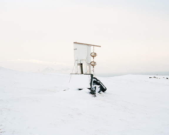
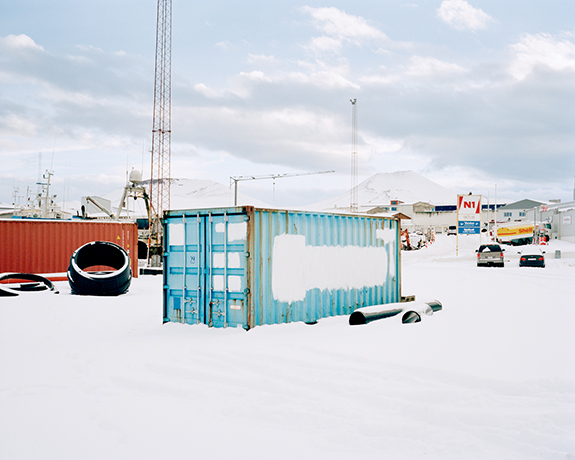
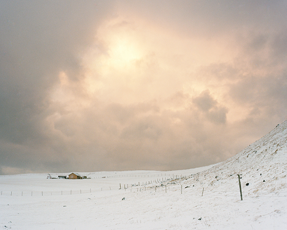
Where the Land Rises is a photographic series documenting the relationship between the landscape and people of Heimaey, the only inhabited island of Vestmannaeyjar, a volcanically active archipelago in southern Iceland.

Isolated from the Icelandic mainland by the North Atlantic Ocean, Vestmannaeyjar is a dramatic fleet of around 15 islands. Heimaey, which literally means Home Island, is the largest of these islands with an area of approximately five square miles and home to a population of 4,300 people. Two cindery domes dominate the island’s horizon, sitting like residual slag heaps from a heavy industry long abandoned. These volcanoes, known as Eldfell and Helgafell, reveal the temporality of the
 Mid-Atlantic Ridge. Lying directly between the shifting tectonic plates of Europe and North America, the geology of the Vestmannaeyjar range is relatively new, having been formed by multiple volcanic eruptions during the past 12,000 years. 

In the early hours of 23rd January 1973 the island of Heimaey suddenly split open, sending columns of lava into the sky from a mile-long fissure. The eruption of Eldfell — as the 42-year-old volcano is now known — led to the immediate evacuation of the island, destroying many homes and violently altering the geography of Heimaey. For this reason, the island is often cited as the “Pompeii of the North.”

As the lava flow slowly crept towards the fishing harbour, threatening to destroy the island’s economic lifeline, interventions were made to divert the drifting magma. A dam of solidified basalt was successfully created by spraying the flow with billions of litres of seawater. In early July 1973 the eruption was officially declared over and many of the inhabitants began to return, although some would never come back. The island had been saved but the landscape would never be the same again. In less than six months Heimaey had grown by an area of 20%. The new landscape formed by the eruption is a topography significantly influenced by mankind and the event is cited as an archetypal example of man’s ability to conquer the overwhelming power of nature.

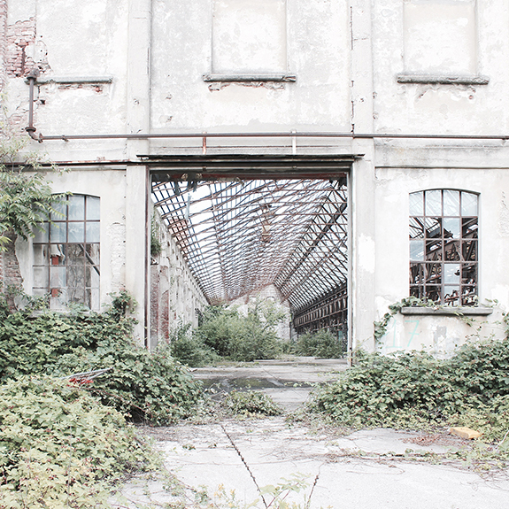
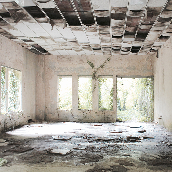
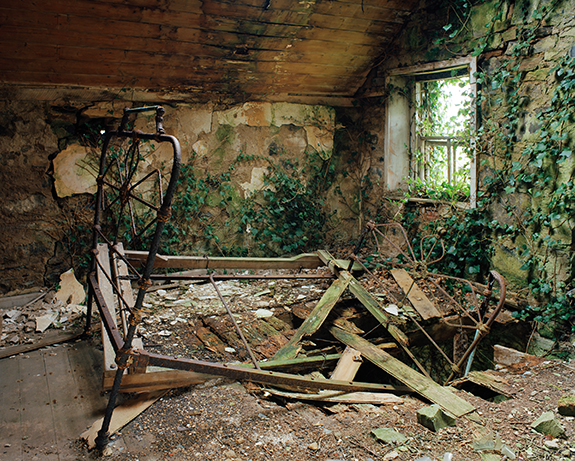
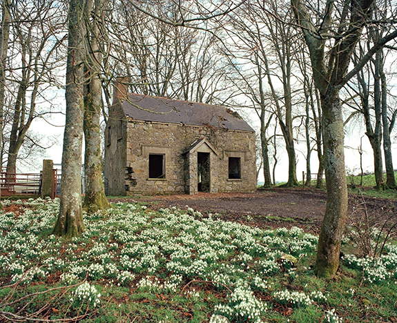
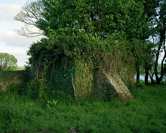
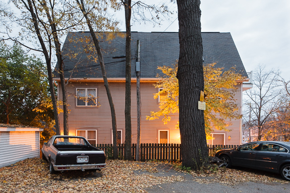
Where the Land Rises captures the stark coastal terrain of Vestmannaeyjar, a restless landscape forged by an intense geological violence that originates deep within our planet. Nevertheless, the landscape of Heimaey is revered by its inhabitants as a home; an island refuge in an often unforgiving environment. My portraits document some of the people who live there; the permanent occupants of a landscape exposed to ongoing forces of destruction and creation; the everyday witnesses of a terrain intricately textured by an ever-changing climate. A people who exist between a landscape gone and a landscape to come.
By documenting the portraits and stories of several people who experienced the eruption of Eldfell,
I was able to imagine a past landscape now lost beneath the lava and investigate a moment in Heimaey’s recent history when the island’s entire community came unnervingly close to losing everything.

Where the Land Rises explores the complex interrelations between the changing environment and mankind against the unpredictable geography of Vestmannaeyjar and the surrounding extremes of the Mid-Atlantic Ridge. In examining this space, I present themes of isolation and man’s inherent longing for order within a fluctuating environment. By further detailing the lasting affects of the eruption of Eldfell I introduce ideas of loss, remembrance, the passing of time, and the chance for new beginnings. Where the Land Rises ultimately considers our perception of the landscapes that surround us, but more significantly, how the changing environments we inhabit shape the human condition. 

— Peter Holliday, Glasgow, Scotland

© Peter Holliday

© Peter Holliday3