Peter Holliday

NOV 2 Peter Holliday

PeterHollidayPhoto.com

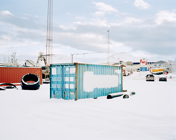
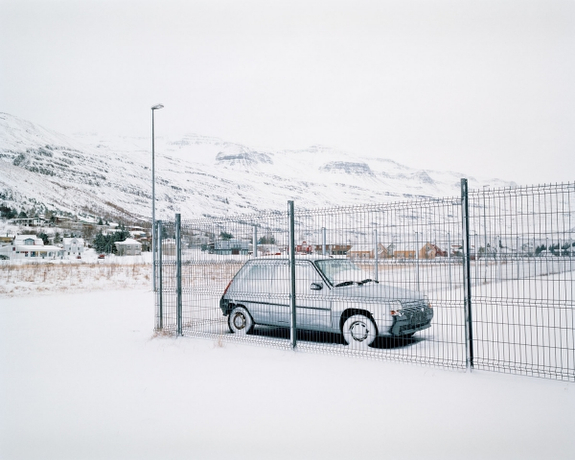
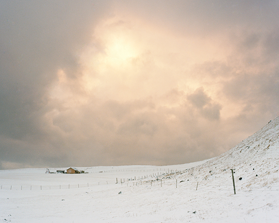
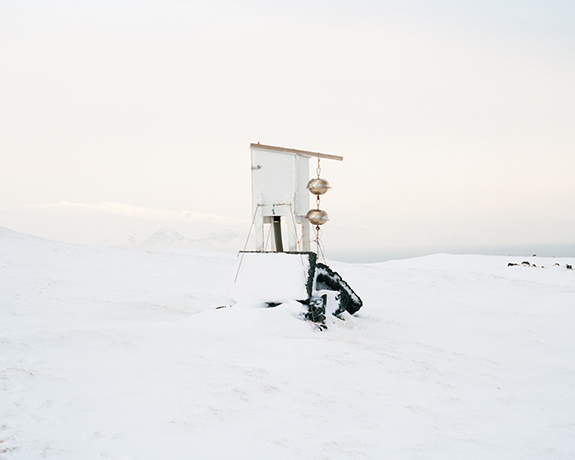
Where the Land Rises is a photographic series documenting the relationship between the landscape and people of Heimaey, the only inhabited island of Vestmannaeyjar, a volcanically active archipelago in southern Iceland.

Isolated from the Icelandic mainland by the North Atlantic Ocean, Vestmannaeyjar is a dramatic fleet of around 15 islands. Heimaey, which literally means Home Island, is the largest of these islands with an area of approximately five square miles and home to a population of 4,300 people. Two cindery domes dominate the island’s horizon, sitting like residual slag heaps from a heavy industry long abandoned. These volcanoes, known as Eldfell and Helgafell, reveal the temporality of the
 Mid-Atlantic Ridge. Lying directly between the shifting tectonic plates of Europe and North America, the geology of the Vestmannaeyjar range is relatively new, having been formed by multiple volcanic eruptions during the past 12,000 years. 

In the early hours of 23rd January 1973 the island of Heimaey suddenly split open, sending columns of lava into the sky from a mile-long fissure. The eruption of Eldfell — as the 42-year-old volcano is now known — led to the immediate evacuation of the island, destroying many homes and violently altering the geography of Heimaey. For this reason, the island is often cited as the “Pompeii of the North.”

As the lava flow slowly crept towards the fishing harbour, threatening to destroy the island’s economic lifeline, interventions were made to divert the drifting magma. A dam of solidified basalt was successfully created by spraying the flow with billions of litres of seawater. In early July 1973 the eruption was officially declared over and many of the inhabitants began to return, although some would never come back. The island had been saved but the landscape would never be the same again. In less than six months Heimaey had grown by an area of 20%. The new landscape formed by the eruption is a topography significantly influenced by mankind and the event is cited as an archetypal example of man’s ability to conquer the overwhelming power of nature.

Where the Land Rises captures the stark coastal terrain of Vestmannaeyjar, a restless landscape forged by an intense geological violence that originates deep within our planet. Nevertheless, the landscape of Heimaey is revered by its inhabitants as a home; an island refuge in an often unforgiving environment. My portraits document some of the people who live there; the permanent occupants of a landscape exposed to ongoing forces of destruction and creation; the everyday witnesses of a terrain intricately textured by an ever-changing climate. A people who exist between a landscape gone and a landscape to come.
By documenting the portraits and stories of several people who experienced the eruption of Eldfell,
I was able to imagine a past landscape now lost beneath the lava and investigate a moment in Heimaey’s recent history when the island’s entire community came unnervingly close to losing everything.

Where the Land Rises explores the complex interrelations between the changing environment and mankind against the unpredictable geography of Vestmannaeyjar and the surrounding extremes of the Mid-Atlantic Ridge. In examining this space, I present themes of isolation and man’s inherent longing for order within a fluctuating environment. By further detailing the lasting affects of the eruption of Eldfell I introduce ideas of loss, remembrance, the passing of time, and the chance for new beginnings. Where the Land Rises ultimately considers our perception of the landscapes that surround us, but more significantly, how the changing environments we inhabit shape the human condition. 

— Peter Holliday, Glasgow, Scotland
© Peter Holliday

© Peter Holliday3

François Quévillon

© François Quévillon

Francois-Quevillon.com

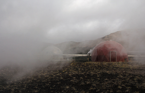
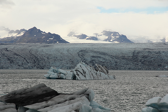
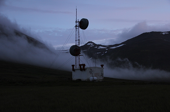
I began this project during an artist residency in Iceland in August 2014. I was on a road trip when warnings of the possible eruption of the Bárðarbunga subglacial stratovolcano begun. Watching some apocalyptic media coverage while consulting webcams and data from surveillance systems influenced me to make audiovisual recordings of remote monitoring devices, of the territory’s transformation due to volcanic activity, as well as geothermal phenomena and power plants. Made of field recordings and stationary camera shots, the audiovisual piece has a documentary style. Due to its non-linear structure, the work unfolds in an unpredictable manner and its conclusion remains unknown.

The piece consists of a database of hundreds of video loops presented according to the evolution of a statistical model that integrates data coming from the sensors of the computer that runs the installation: temperature of components, fan speed and energy consumption. This information is displayed as unidentified graphs on a second screen. High levels of activity and electricity consumption will lead the device to display energy-charged audiovisual scenes, while low levels will transport the audience to contemplative spaces that seem to be frozen in time. The system’s monitoring influences the course of events it presents, and vice versa.

— François Quévillon, Montreal, Canada

© François Quévillon

© François Quévillon3

Christina Evans

© Christina Evans

ChristinaEvans.co.uk

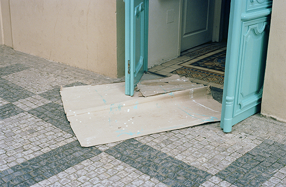
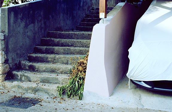
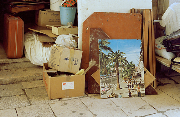
Taken over a month-long journey, the photographs are a visual engagement with the immediate surroundings, noticing subtle moments in the ordinary. Observing traces of everyday life, the camera’s frame was used as a tool to record happenstances. Led by accidental arrangements left behind by the passer-by it becomes an interaction with a stranger and reflects ephemeral moments of chance encounters.

— Christina Evans, Winchester, England

© Christina Evans

© Christina Evans3

Andrew Mellor

© Andrew Mellor

AndrewMellorPhotography.com

Deindustrialisation is a process of social and economic change caused by the removal or reduction of industrial capacity or activity in a country or region. 

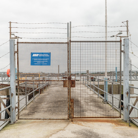
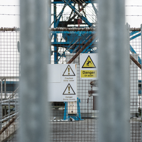
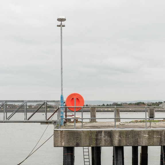
For most of the 20th century, Fleetwood was a prominent deep-sea fishing port, but, since the 1970s, the fishing industry has declined precipitously and the town has undergone economic difficulties. I am very interested in the way this has affected the landscape and the area.

The Port of Fleetwood provided ro-ro (roll on-roll off) traffic to and from Northern Ireland and was a busy fishing port for many years. The port played a significant role in enhancing the connectivity of the wider region and the movement of freight, as well as providing jobs. Aspirations to revive this role remain, so operational areas at the port are protected and safeguarded with fences and barbed wire.

Questions of land use, industry and the effect of the decline on the economy, form the basis of the enquiry. The main concept is to represent the effects of deindustrialisation on a specific place and to show how this affects the political landscape.

— Andrew Mellor, Lancashire, England

© Andrew Mellor

© Andrew Mellor3

Mark Havens

© Mark Havens

MarkHavens.com

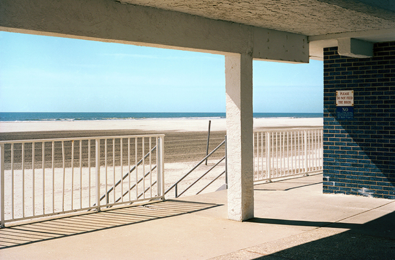
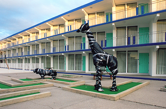
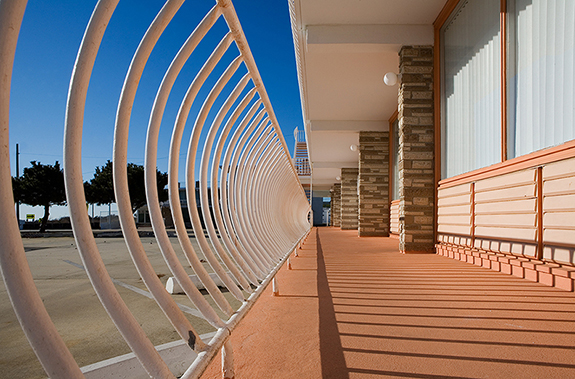
Much of my work could be seen as an attempt to decelerate or suspend the irreversible flow of time. The Out of Season series uses the disappearing motels of Wildwood, New Jersey as its subject matter and endeavors to bring out the interplay of an idealized past and its inexorable disappearance.

People inhabit these images only by inference and allusion; and in many ways, it’s this physical absence from which the work draws its strength. Impressions are made at a more elemental depth, below explicit communication, echoing that most universal of all human experiences: the relentless passage of time what is left behind in its wake.

When I make photographs, I continually find myself coming back to something Milton Glaser said: “I am more interested in what you can’t tell a story about. Which is to say, the overtones of our subconscious, the connections that are made below the level of narrative.” 

— Mark Havens, Philadelphia, Pennsylvania, USA

© Mark Havens

© Mark Havens3

Lorraine Turci

© Lorraine Turci

LorraineTurci.com

My work is concerned with landscapes faraway, journey and memory.

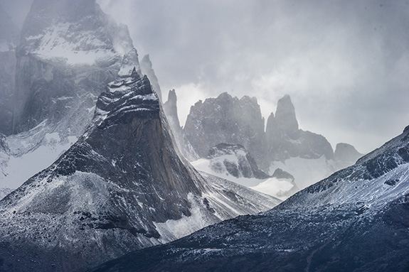
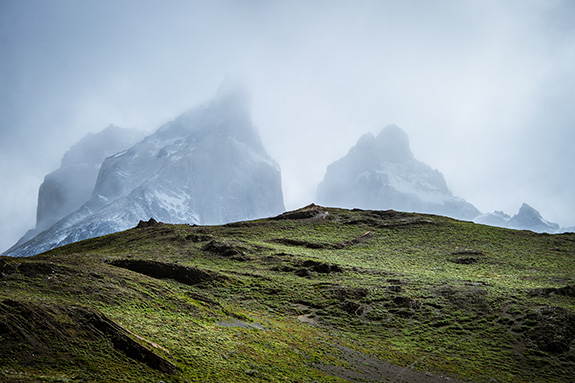
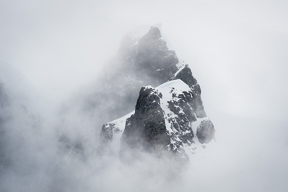
Akmê (from the ancient Greek word “summit”) is a series of 19 photographs taken within this last year in arctic and antarctic polar zones. It falls both within a documentary approach made of distant sobriety, and a research of aesthetic writing.

Mountains of Arctic Spitsbergen, Chilean fjords, Tierra del Fuego or the Antarctic Peninsula — the summits are dissimilar but somehow always the same. Inaccessible, indomitable, they are isolated from their landscape to be unified in a resurgence of the sublime.

Tangible marks of the changes of the planet, these heights are out of scale, appeased in temporality.

— Lorraine Turci, Montreal, Canada

© Lorraine Turci

© Lorraine Turci3

Xuecong Lin

© Xuecong Lin

LinXuecong.com

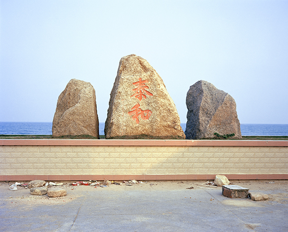
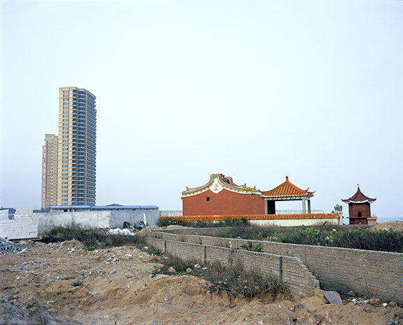
I was born and grew up in a southern coastal city of China, witnessing the development, transformation, as well as the increasing contradictions. 

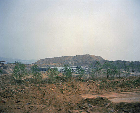
Last year, I tried to use the most direct approach to take the photos along the southeastern coastal line. What I saw was completely different from that in my childhood as the result of the construction projects. 

All the things lost their identity, which made me feel the change here was so fast, including not only the environment, but also the customs, beliefs and families. 

At that time, a sense of strange and sad was raised in my mind. What I can do now is to 
slowly pick up these memories, which is a return and desire as well as the most 
primitive expression of my heart. 

— Xuecong Lin, Shenzhen, China

© Xuecong Lin

© Xuecong Lin3

Women in the Landscape

© Jessica Auer
© Jessica Auer

Four artists, all of whom were featured on this blog, came together last month in Portland, Oregon, to reflect on a show of their work, Women in the Landscape. Zach Krahmer made a video of the discussion at Newspace Center for Photography, which hosted the exhibit. Jessica Auer, Jennifer Colten, Lauren Henkin and Dawn Roe participated in the discussion, moderated by Paul Sutinen. The 83-minute video is here.

The artists’s websites, well worth studying, are here: Jessica Auer, Jennifer Colten, Lauren Henkin, Dawn Roe.

© Jennifer Colten
© Jennifer Colten
© Lauren Henkin
© Lauren Henkin
© Dawn Roe
© Dawn Roe

William Ash

© William Ash

HakusanCreation.com

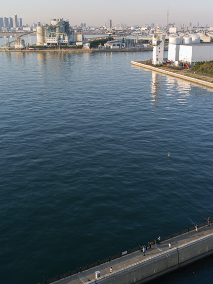
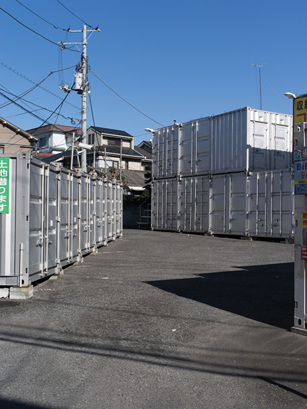
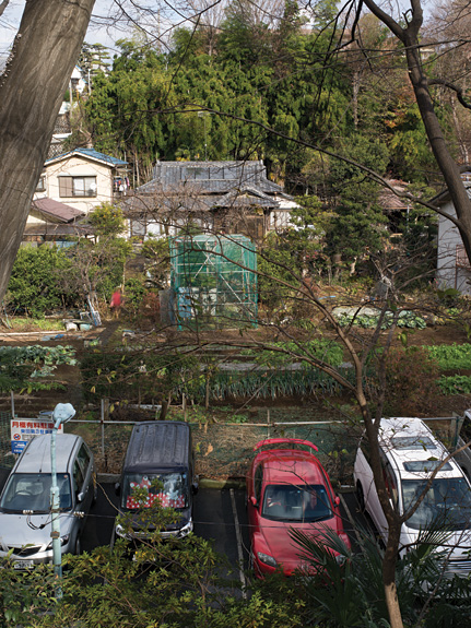
I am a photographer and book artist living in Maine. I have just completed my latest book Earth, Water, Fire, Wind, Emptiness. In it, I attempt to create a history of Tokyo through its landscape. The title refers to the elements of nature in Buddhism. Each element refers not only to physical properties of the world, but also the psychological nature of an animate being, creating a dichotomy of the object and observer.

I am fascinated by our perception of an image, the aesthetic response, and the change in perception with knowledge of what is represented. Landscapes are a complex layering of material and form that reflect the chronology that created them. Our immediate response is very intuitive—we engage with the shapes, colors, and textures. Our experience of particular elements, trees, rivers, buildings, etc., create associated impressions, which can be unique to an individual. The landscape can go through another transformation with information that is not apparent, for example, all the islands and coastline in Tokyo are artificial, representing about 100 sq. mi. of reclaimed land—the landscape in Tokyo bay even 60 years ago would have just been open water. My book is available on my website.

— William Ash, Litchfield, Maine, USA

© William Ash

© William Ash3

Angela Kelly

© Angela Kelly

AngelaKellyPhoto.com

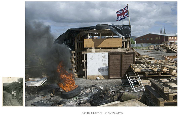
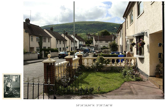
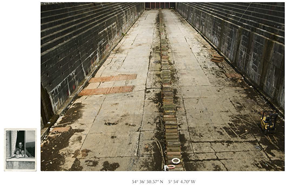
In Catharsis: Images of Post-Conflict Belfast, I explore to what degree the language of the snapshot contributes to or obscures our understanding of time and place. Juxtaposing snapshot photography from my Belfast family album with newer documentary images of urban Belfast in the post-conflict present, I situate each image in relation to an unspoken memory, and a troubled history, while marking each piece with its GPS coordinates, as a reference to its military historical legacy. Each site photographed is a former ‘Troubles’ site, now a Tourist site. Walking along the Peace walls on its Protestant side, I recall personal family album images taken on the Catholic side. The GPS is a reminder of Belfast’s history with its absent military ‘presence.’ The stark contrast in scale and genre, between the personal album images and the more public documents helps shape an understanding of the gap between them.

— Angela Kelly, Rochester, New York, USA

© Angela Kelly

© Angela Kelly3