Tamim Jamshed

© Tamim Jamshed

www.TamimJamshed.com

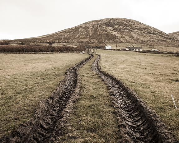
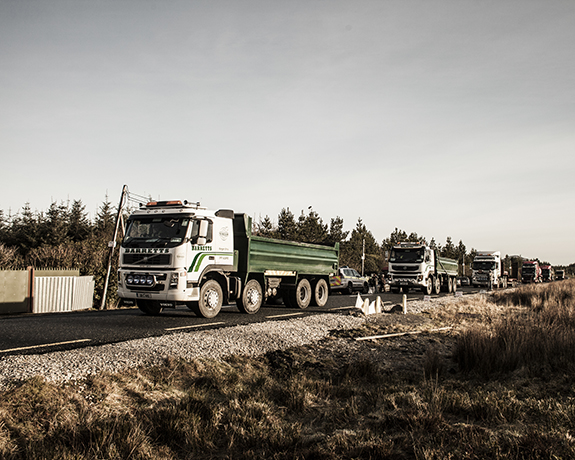
Ireland has a high dependence on oil, presently 56% of its energy comes from it and 25% is from gas. Off the west coast of Co. Mayo, the Corrib gas field is now owned by the exploration company British Dutch Shell (BDS) and contains at least 1 trillion TFC of natural gas. They are laying a high-pressure gas pipe 9KM long through Rossport village to carry the raw and liquid material to the refinery in middle of the local forest. The organization named Shell to Sea, with the help of local villages, is protesting against BDS to save their local environment that is threatened by the company. But it’s not easy to get anything positive where the authorities are involved. To build the refinery and the gas terminal Shell bought 400 square km of state forestry land from Coillte, the state forestry.

The high-pressure gas pipeline is planned so close to homes; schools and local places could seriously affect the community in the event of pipe failure. On the other hand BDS already discharged liquid aluminum into the only resource of natural drinking water of several villages. The local economy is based on a small amount of tourism, fishing and farming. Now they believe their livelihood and jobs are being directly threatened by Shell’s project in their village.

The Irish people stand to gain nothing from the exploitation of their own natural resources, while seeing only detriment to their economy and environment. All the profits and benefits from this project will end up in the hands of the multinationals.

— Tamim Jamshed, Dublin, Ireland
© Tamim Jamshed

Ian van Coller

© Ian van Coller

www.IanvanColler.com

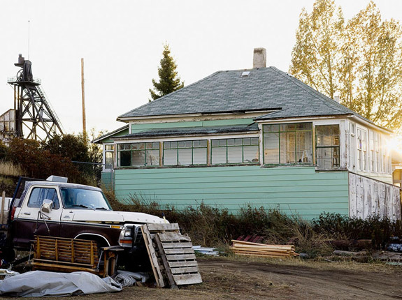
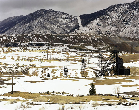
Once known as “The Richest Hill on Earth,” Butte is not your typical mining town. At the end of the 19th century, Butte mines were the largest producers of copper in the world, with the dominant share of copper wire used to electrify the United States coming from this one mountainside.

Butte’s colorful and controversial history includes the murder of union activist Frank Little, the establishment of one of the first successful mine unions in the nation, the bulldozing of worker neighborhoods by the Anaconda Mining Company in the 1950’s, and the eventual abandonment of the copper mines in 1974, leaving behind the largest superfund site in the United States.

Butte is struggling to redefine itself as a place of interest, based largely on its epic history, as much as it is to its current status as the epitome of man-made ecological devastation. In conjunction with Anaconda, Butte and its surrounds constitute the largest historic preservation district in the nation, with over 6000 properties. How does a community of 30,000 people cope with this legacy and define for itself a plan for future sustainability? By focusing on Butte’s landscapes, vernacular architecture and portraits of local residents, I hope to inspire viewers to consider how the impacts of a community’s past shape its present state of cultural, economic and ecological health.

Ian van Coller, Bozeman, Montana, USA

© Ian van Coller

Ashley M. Jones

© Ashley Jones

www.AshleyMJones.com

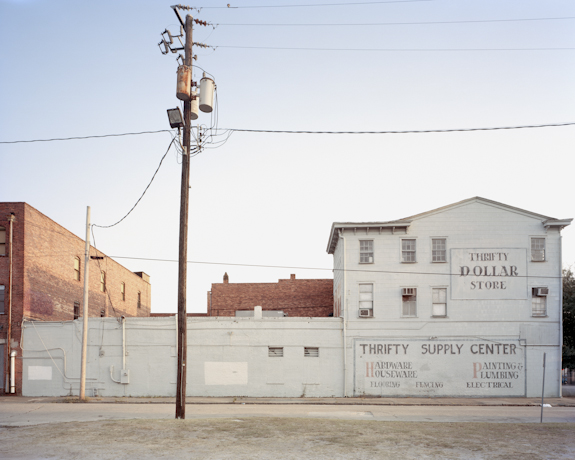
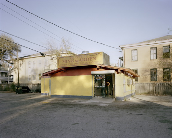
The mass production and relative affordability of the automobile in the early 20th century resulted in considerable changes to our nation’s infrastructure and the need to intersect highway systems with urban neighborhoods. As a resident of Savannah, Georgia, I am fascinated by the rich history and historic architecture of the city. However, there is a stark division between the restored and legally protected buildings within the central National Historic Landmark District and the struggling, run down neighborhoods that surround it. I am specifically interested in the at-risk neighborhoods along Martin Luther King Jr. Boulevard and the ways in which they have been impacted by the construction of the Interstate 16 flyover.

This elevated section of Interstate 16, the Earl T. Shinholster Bridge, held its official ribbon cutting in 1967. The construction of the interstate coincided with several other large-scale urban renewal projects including the construction of Kayton and Fraiser homes south and east of the flyover. It intersects with the Westside of Savannah in the historically African American “Frogtown” neighborhood — a neighborhood that has been on the decline since the interchange was completed.

In 2010 I began photographically documenting the homes, businesses, and churches in the area immediately surrounding the flyover. My documentation has since expanded to include neighborhoods south of Frogtown and extending several blocks south to Victory Drive. This area includes Cuyler-Brownsville, a neighborhood similarly impacted by connection of 37th Street to I-16.

My photographs depict the current state of this community and the architectural structures that remain to provide an understanding of the historic and contemporary context of this community. I am further exploring local movements to renew and revive Martin Luther King Jr. Boulevard and the neighborhoods immediately impacted by the Interstate.

— Ashley M. Jones, Savannah, Georgia, USA

© Ashley Jones

Buzzy Sullivan

© Buzzy Sullivan

www.BuzzySullivan.com

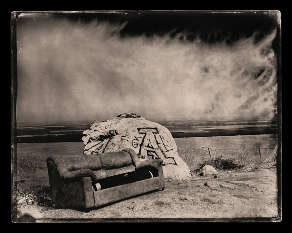
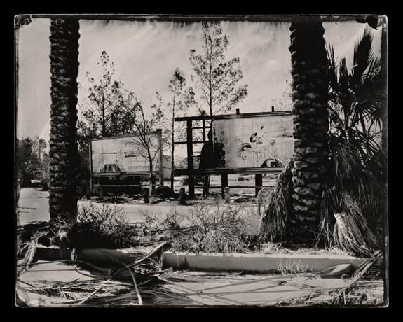
This body of work is an exploration of the rapidly-changing landscape of the American West, devastated by the depletion and manipulation of water and water rights. This work focuses on the engineered ruins of California: I aim to pose a series of questions about the sustainability of agricultural and population booms in the semi-arid state.

I shot the images that make up The Smell of Success / The Effects of Decay as 8×10 wet-plate ambrotypes, which is the same photographic process used by the post-Civil War photographers who traveled with government-sponsored surveys to document the then uninhabited West. Their 19th-century images created a sense of what could be tamed and owned in the American West. My photographs emulate my predecessors’ images, allowing the viewer a vantage point to contemplate how we as a society have managed resources in some of the most environmentally-fragile areas over the past century.

Buzzy Sullivan, Portland, Oregon, USA

© Buzzy Sullivan

Tony Murray

© Tony Murray

www.TonyMurray.ie

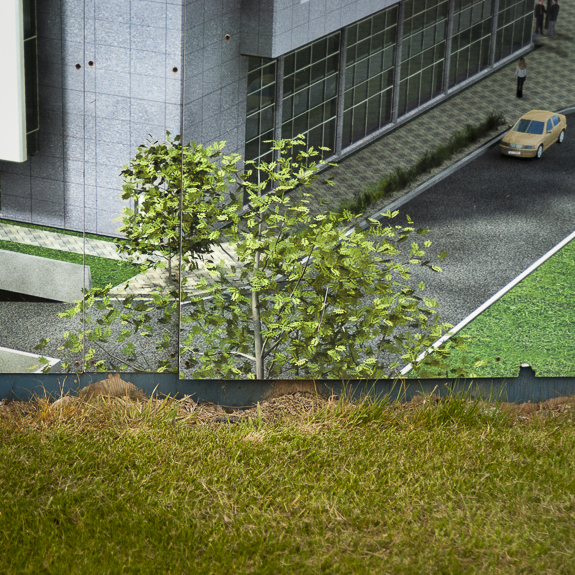
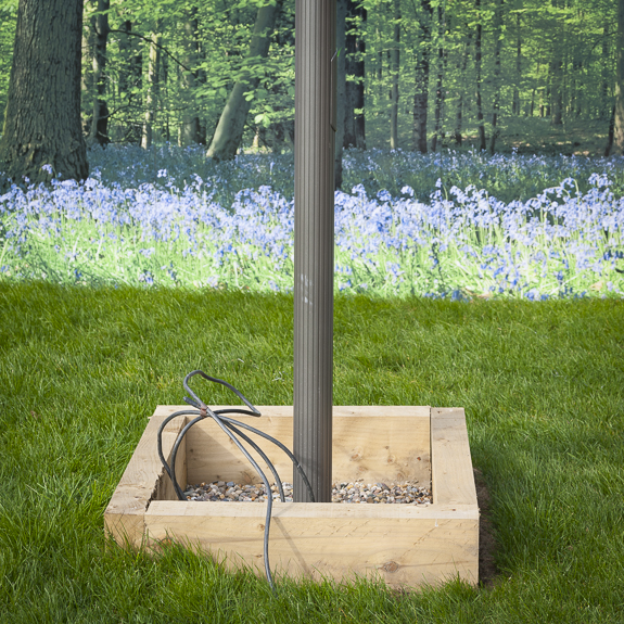
I am drawn and excited by the transformation that happens when the seemingly banal and everyday is transformed into an abstraction by the intervention of the camera. For me, the camera always lies — it is not about truth or fact but “story.” Imagined Lands documents the idealized landscapes that were created to lure and sell property during the boom years of the Celtic Tiger era. The images appeared on hoardings [temporary walls] that were erected to lure potential house buyers and promised a life of bounty and fulfillment. My images create an ambiguous and sometimes wry juxtaposition between the “real” and the “imagined.” 

— Tony Murray, Dublin, Ireland

© Tony Murray

Harlan Erskine

© Harlan Erskine

www.HarlanErskine.com

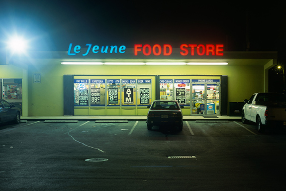
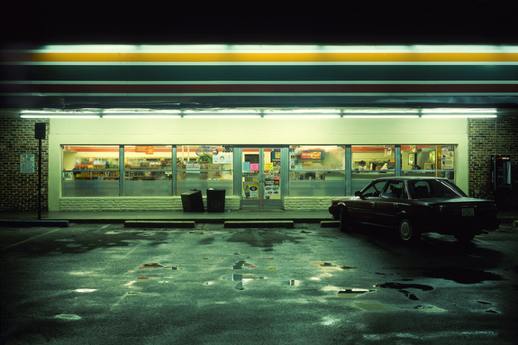
This project, titled ten convenient stores, is concerned with the consumer culture of immediacy, 24-hour availability, information overload, and the loss of local identity. The images were made after midnight and photographed with a 4×5 view camera in a straight-on objective style. I spent many nights hunting for the right locations and shooting conditions.

I was influenced in equal parts by the German photographic team of Bernd and Hilla Becher’s straight compositions of industrial landscapes and Ed Ruscha’s 1963 book Twenty Six Gasoline Stations. I photographed these stores in a straight style so the viewer is drawn to their industrial similarities and the differences in their product displays. By using a large format camera, the scene contains vastly more detail than the human eye can digest at once. Thus, it is an ideal way to document the information overload of our late-capitalistic landscape.

— Harlan Erskine, Brooklyn, New York, USA

© Harlan Erskine

Frederico Colarejo

© Frederico Colarejo

www.Frederico-Colarejo.com

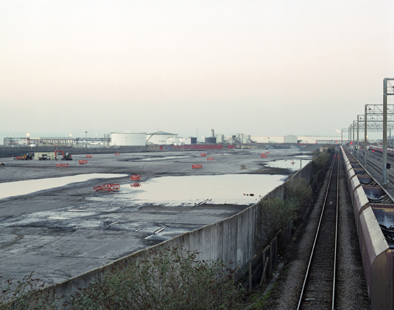
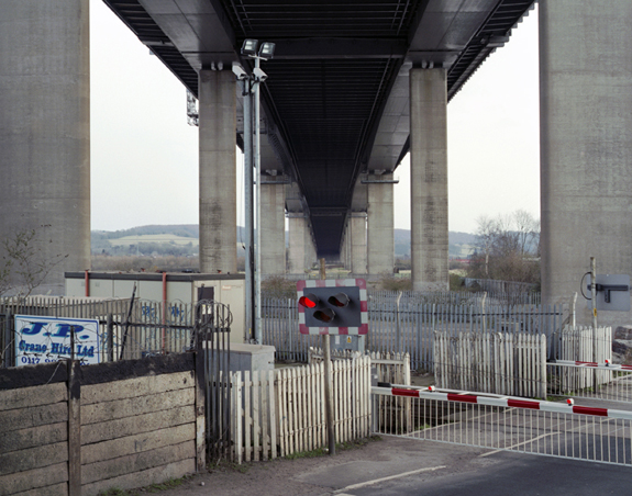
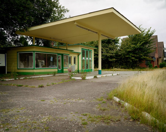
Severn Beach line is a suburban railway line in Bristol, UK. The line was originally built for freight transportation from the Avonmouth docks to the city centre. In the end of the 19th century the railway opened passenger services from Bristol to Avonmouth and Severn Beach, becoming then a very popular train line.

The decline of British industries during the 1950s and 60s and the easy access to other modes of transport caused some difficulties to the railway. It saw a decrease in passenger numbers and for several times it was threatened of being closed. The train services were greatly reduced and all the stations along the line were shut down.

This body of work talks about the survival of a railway and explores the surroundings of the Severn Beach line. With this project I wanted to show what has been left from the railway’s past and how it now blends with the present condition of the line. With these images I make reference to the history of the railway and try to show some of the transformations occurred on Bristol’s urban and industrial landscapes over the years.

— Frederico Colarejo, Bristol, England, United Kingdom

© Frederico Colarejo

Caspar Sessler

© Caspar Sessler

www.Caspar-Sessler.de

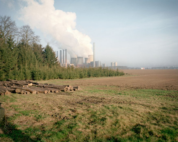
Alarmed by the disaster of Fukushima, Germany’s government has proclaimed the “Energiewende,” a radical turnaround in its energy policy. Shifting the focus from fossil and nuclear to renewable energy sources is the biggest restructuring program since Germany’s reunification. In my graduation project, titled KRAFT/FELDER, I started documenting this long-term project which won’t be finished before 2050. I document both the current means of production as well as the transition towards renewable energy sources. I’m equally fascinated by the unfinished and the gigantic. In the heavily interest-driven day-to-day discussion about the policy I did sense a lack of a neutral and sober position –- a position photography is able to occupy like no other medium.

— Caspar Sessler, Bremen, Germany

© Caspar Sessler

Didi S. Gilson

© Didi S. Gilson

www.Didi-S-Gilson.com

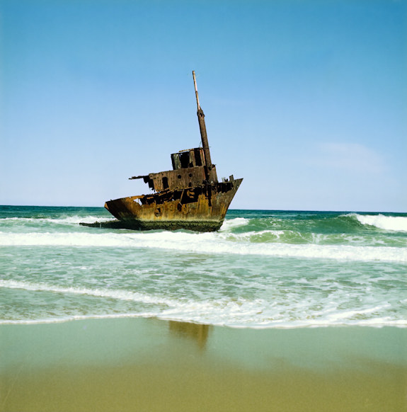
The evidence of human intrusions into the visual landscape of Stockton Bight has included the shipwrecked Sygna’s stern which, although a tourist attraction since 1974, is gradually eroding close to shore.

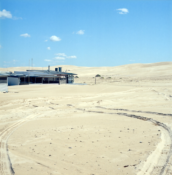
Nearby, semi-permanent and held together as a consequence of native plant life… the dynamic dunes shift with the seasons. Granule by granule, these 32 kilometres of magnificent mounds are wind sculpted and encompass the largest continuous mobile coastal sand mass in the Southern Hemisphere.

During the Great Depression of the 1930s, a small community of squatter shacks, nicknamed Tin City, was jury-rigged in the dunes. While today, as part of the ever increasing  attempts to lure more holidayers duneside, resort accommodations are under construction behind perimeter fencing.

Will future developments progressively intrude on the terra-not-so-firma or will Nature steadily reclaim her beleaguered territory?  Perhaps only time will tell.

— Didi S. Gilson, Anna Bay, New South Wales, Australia

© Didi S. Gilson

Alnis Stakle

© Alnis Stakle

www.AlnisStakle.com

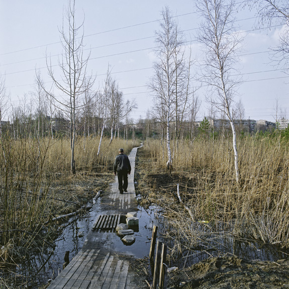
Daugavpils, the second biggest city in Latvia, is located near the border with Belarus, Russia and Lithuania. This location has determined the development of the city’s cultural environment. Since 1209, Germany, Poland, Russia and Latvia have ruled Daugavpils. Constant socio-political changes have instigated migration of various nationalities, with different religions and cultural traditions to and from the city. Today, the society of Daugavpils is truly trans-cultural — a place where identities of these various groups have overlapped, merged and interwoven. This creates a unique cultural environments in Latvia.


As I started taking photos of Daugavpils in 2001, I sought to create a documentary story about the city and its people. I realized, however, that my photographs not only tell a story about Daugavpils, but also about myself, my experiences of walking and observing, the most important and most insignificant in the landscape, the things that cannot be explained, the stories revealed by strangers, the stories that I remember and forget, the nostalgic feeling evoked by remnants of the Soviet epoch in the cityscape.

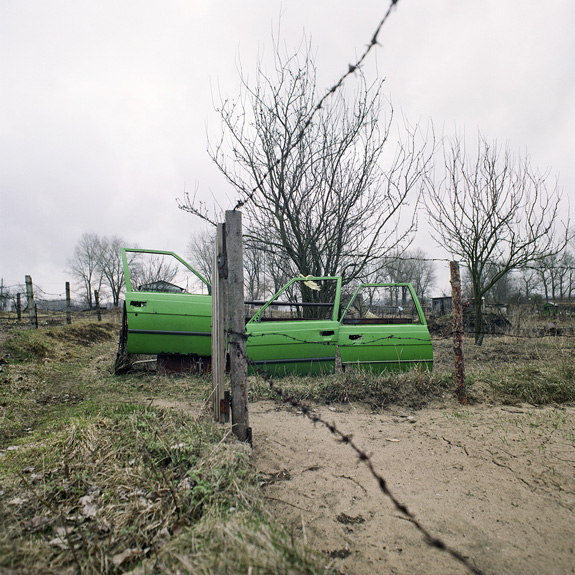
The title of the series, L.S.D., is an abbreviation of Living Space Daugavpils. By creating a purportedly documentary story about the city, I nevertheless want to emphasize the incomprehensible and the unexplainable in the cityscape. For instance, a fence built from three green car doors that encircles a small vegetable garden, a freshly-painted blue water pump on the side of an unpaved road, and a brightly colored metal construction of obscure meaning in the courtyard of a block of flats. Many things in a city environment can often be rationally explained, frequently by the meager budget of the local municipality or its inhabitants.  Yet many things are so odd that they appear irrational, coming from the deepest layers of collective unconsciousness. They have a hallucinatory quality.

— Alnis Stakle, Riga & Daugavpils, Latvia

© Alnis Stakle