Johnna Arnold

www.JohnnaArnold.com

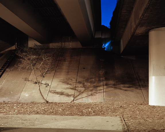
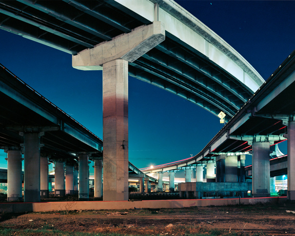
The freeways snuck into my life — from birth I’ve used them without knowing how they were made or who made them. Like our running water and electricity, these resources assist our daily lives, yet we rarely appreciate or acknowledge them. Our progress in mastering the land has separated us from the very thing that gives us life.

In this new body of photographs, called In/Finite Potential, I put myself in context with the Bay Area freeways. I am fascinated by the contrast between these inhospitable structures of utility and a small, fleshy human such as myself. I look for unexpected beauty in these forbidden lands, as I trespass with a combined sense of research and rebellion.

My feelings for these freeways remain complex. I appreciate the actions necessary to create these structures: communal decision-making, resource sharing, and hard physical work. I am fascinated by how these monolithic structures have affected my life, as well as the lives of the people around me. I selfishly value these freeways for their willingness to help me get from point A to B, and for the wealth of experiences that accessibility allows. I am angry with these freeways for their support of our planet’s environmental destruction, and for upholding a theory of progress in which we continue our separation from the land.

Moreover is the freeway’s seeming inability to be loved. I sing it songs, admire its weeds, rummage in its untold nooks and crannies, but as yet it appears unaffected.

— Johnna Arnold, Oakland, California, USA
Cole Whitworth

www.ColeWhitworth.com

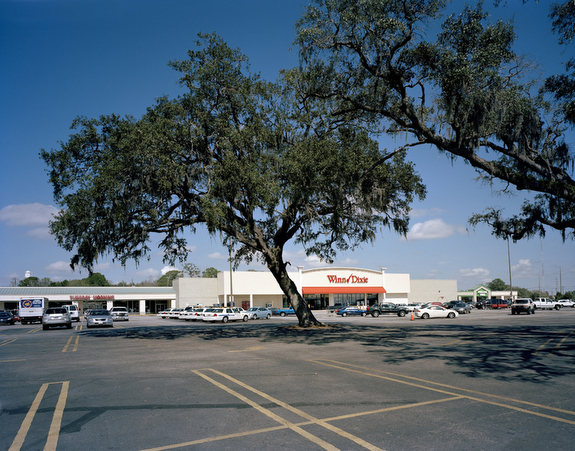
Highway 17 starts in Winchester, Virginia and travels south all the way to Punta Gorda, Florida. The roadway spans 1,189 miles and passes in and out of many towns along the way. This highway was used to travel up and down most of the eastern coastline before I-95 came about in the 1950’s and 60’s. It reflected the era of 1950’s travel motor homes and hotels, Victorian structures and WWII-era Liberty Shipworks. Since then, use of Highway 17 has greatly declined and it shows.

The highway acts as the gateway to the “The Golden Isles,” which includes Sea Island, Jekyll and St. Simons, as well as a way to get to historic Brunswick in southern Georgia. As a result of the great decline in use, the highway now showcases the effects of poor urban planning: along with ugly billboards, poorly-laid-out intersections, ruined and abandoned buildings, and clutter that doesn’t display or reflect the beauty of the coastal marshes and waterways all around you.

By documenting the area with the use of large format photography, my goal with this work was to show the structures along the highway that give evidence as to why there needs to be a focus on preserving and re-building Coastal Highway 17 as it enters and exits the city of Brunswick, GA. I focused on showing the poor use of land, the deserted buildings, the pollution sites and other eyesores that conflict with how the area should be organized. The city of Brunswick and Highway 17 stand as a model for so many other cities all across the United States that have the same problems and a need for preserving the historic and scenic qualities of these gateways.

— Cole Whitworth, Savannah, Georgia, USA

Alfredo De Stefano

www.MisDesiertos.com

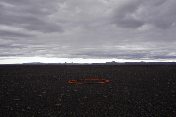
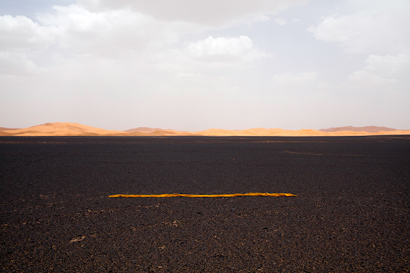
In my photographs from the last few years, I have intervened upon the landscape, creating scenes or sets with a wide range of natural and manmade elements. In this way, amidst the sometimes oppressive vastness, I construct and photograph intimate spaces: some of them are metaphors for the painful desertification of the planet caused by man, while others work as ironic allusions to our relationship with the desert.

The action I perform deals with reintegration: it’s a reflection on what the desert has lost, but also a way of restoring its ravaged memory through a personal intervention. Obviously, in the desert, this intervention is something ephemeral, but nonetheless transcendent in the photographic memory that has managed to lend substance to a desire.

— Alfredo De Stefano, México City, México

Céline Clanet

www.CélineClanet.com

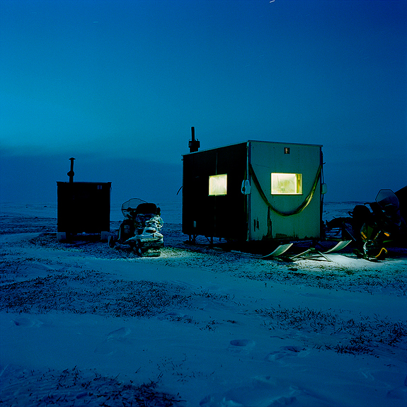
Since 2005, I have been traveling regularly to Máze, a small Sámi village located at the highest point of the European map, far above the Arctic Circle, in Norwegian Lapland. There, I met quiet people, sometimes melancholic, captivating, who are very proud of their village and territory. They often have binoculars at hand, even in their homes, to gaze at these beautiful landscapes.

I have photographed Sámi people, houses, land and reindeer that were almost not here today. They barely escaped being flooded by the waters of a hydroelectric dam project that the Norwegian government planned in the early 1970’s and thanks to Sámi people’s protests and resistance was fortunately aborted.
But I have also photographed a reality that will undoubtedly transform in the coming century, due to global warming and cultural integration.

To me, Máze is an ambivalent symbol of resistance and helplessness. Pride as well as suspicion, solitude and great beauty prevail there. In the most beautiful tundra of the Arctic region, I tasted Ante’s and Ole Ailo’s favorite season, when days get longer and temperatures become milder. The perfect moment, when time doesn’t exist anymore and night is gone, when Sámi people immerse themselves in their favorite activities: fishing through ice holes in Lake Suolojávri and riding the snøskuter in the tundra. And all these hours spent with friends, family, outside on a reindeer skin, in a hytte or under a lávvu, talking, joiking, or lying down doing nothing, saying nothing. Just being.

— Céline Clanet, Paris, France


Dawn Roe

www.DawnRoePhotography.com

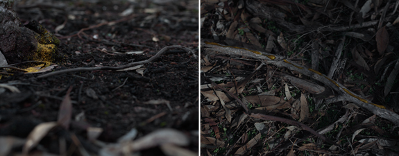
Goldfield Studies began during my time as artist-in-residence at the Visual Arts Centre of LaTrobe University, located in the Goldfields region of Australia.  The photographs and video works produced serve as a record of my response to the surrounding bushlands and the disparate histories that comprise this space. Though not always visible, the abandoned mine shafts that pierce these grounds serve as markers, unearthing a complex web reaching back to the era of the first gold strikes the region is known for. 

During my time in the Goldfields, I came to understand this space as repository of cultural memory constructed from the opposing perspectives of indigenous and colonial settler narratives, pastoral landscape representations, folklore and myth.  Confronted with this past, I found myself looking to uncover the poignancy of present moments, and the fleeting resonance of immediate experience.  My process combines a documentary approach with direct interventions into the landscape as well as constructions in the studio.  Deliberately clunky fabrications incorporate gold fabric and other materials that refer to mining, while also echoing the unsettling imagery of gothic fairytales that intermingle with this space.

While the particulars of location are essential to this series, the impetus for the work was a desire to reconcile documentation and interpretation. The layered narratives of the Goldfields, the palpable passage of time, suggested a rethinking around the formal language of the still and moving image.  I work with paired and multiple panels in an effort to deny a singular experience and to address the cognitive shifts between now and then, here and there.  Each view is represented as a distinct observation, emphasizing the necessary duration of present experience, suggesting that “your perception, however instantaneous, consists in an incalculable multitude of remembered elements; and in truth, every perception is already a memory.” (Henri Bergson)

— Dawn Roe, Winter Park, Florida, USA

Chang Kyun Kim

www.ChangKimPhotography.com

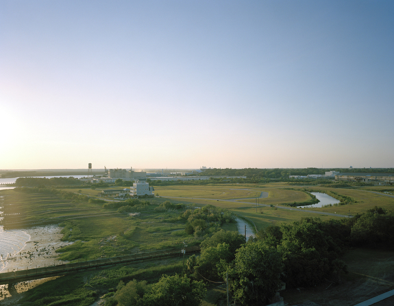
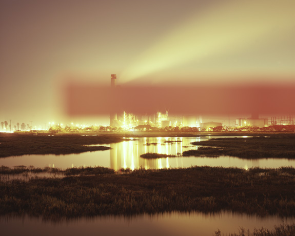
When I moved to California, I was surprised by the number of power plants and oil refineries that were adjacent to local communities. However, the more surprising thing was that many of the residents in the areas didn’t even know what the facilities were.

The title Intervened Landscapes first indicates the physical intrusion of the facilities into natural landscapes. They always seem to be eyesores but somehow are accepted and forgotten by people. More importantly, it also means some kind of invisible intervention that obscures our minds toward the whole energy industry, which can be government control and high-level security, or contribution to communities such as local developments that all have friendly-looking slogans.

By putting color palettes in front of the lens and blocking the facilities in the frames, I wanted to imply people’s view intervened by the industry’s secrecy and the forceful friendliness.
 
— Chang Kyun Kim, Los Angeles, California, USA

Eldar Zeytullaev

www.EldarZeytullaev.com

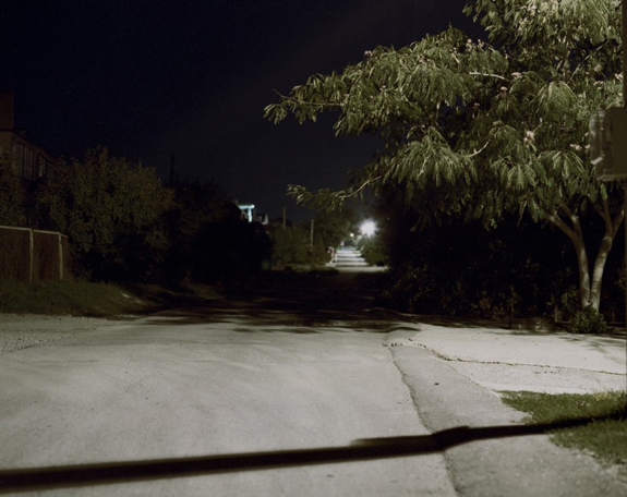
Meeting Place. Basically, this place is in our consciousness. Meeting place with yourself, with your thoughts and stereotypes.
Images in a series, spaces in which things occurred, or could have. These are places with shadow sites of our consciousness. Having pressures or fears, not everyone takes a step to this place.

— Eldar Zeytullaev, Novorossiysk, Russia

Matt Rahner

www.MattRahner.com

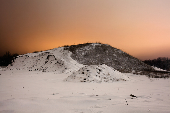
My photographs engage a space in time which is not day or night, yet not in the traditional sense of dawn or twilight. Rather, I work with the illumination of a perpetual, artificial gloaming. Making use of available light pollution I make exposures which capture a romanticized view of liminal space: in-between spaces which are characterized by their dislocation from suburban utility.

Although my subjects are ubiquitous and familiar they exist outside our periphery as travelers. Yet when lit with artificial light they are transformed and achieve an illusory, seductive quality. This seduction becomes problematic when one realizes that their appeal lies in the man-made byproducts of light pollution and commercialization. When my photographs are successful there exists a tension between what is beautiful and at the same time intrusive; this dichotomy is what motivates my work.

— Matt Rahner, Columbia, Missouri, USA

Erik Sæter Jørgensen

www.ESJ.no

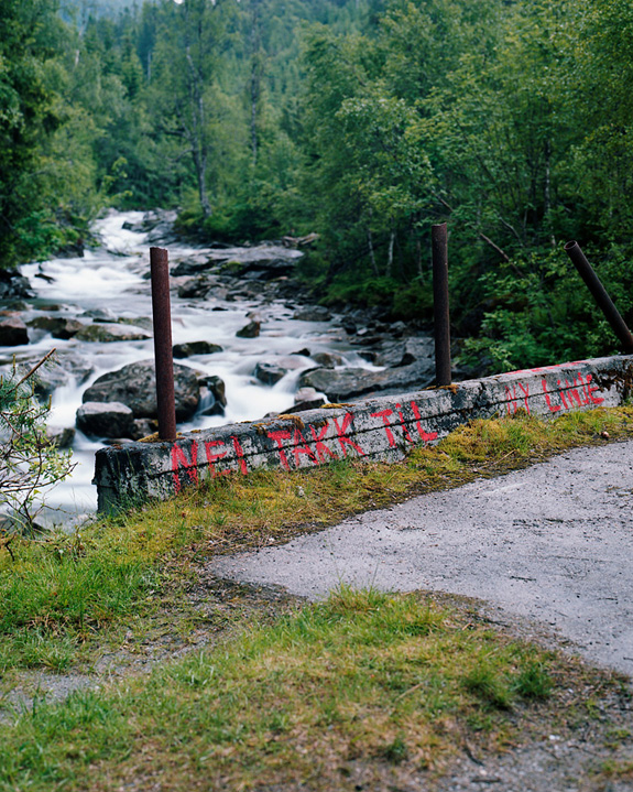
Hardanger is a geographic area in the Norwegian west. The fjords of the west are a UNESCO World Heritage site, and the Hardangerfjord is the third-largest in the world. The awesome beauty and the arch-typical Norwegianness of the region has made sure it’s been depicted more often than any other part of romanticist Norway.

Today, Hardanger is being destroyed by unrestrained capitalism and nebulous political forces. Under the guise of securing the power supply of Norway’s second largest city, Bergen, the government — through the state-owned company Statnett — has powered through the decision to build a new power line cutting through the unique landscape. In reality, the line is being built to provide the oil rigs in the North Sea with electrical power. This in turn enables Norway to shift a large part of its C02 emissions onto other European countries.

I started photographing the area in the summer of 2011, before most of the construction work had begun. A few weeks ago I returned to join the activists in their last act of civil disobedience. “This will never be forgiven,” said one of the banners. The line will soon be finished, but I will return.

— Erik Sæter Jørgensen, Stavanger, Norway

Ryan Koopmans

www.RyanKoopmans.com

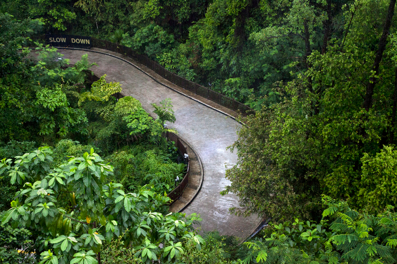
Paradise Now explores how urban fantasies and construction function as expressions of nationalistic ambition, blurring the line between the natural and artificial within the hypermodern city.

Paradise Now is driven by my ongoing curiosity into the human condition, and a desire to visually interpret socio-cultural phenomena within both natural and man-made landscapes. I am drawn, photographically, to the world’s rapidly-expanding and hyper-globalized cities, particularly those that have invested heavily in large-scale urban planning and modernist/futurist architecture. I find that the topographically surreal environments that are products of that planning and architecture set the stage for interesting photo opportunities, from close up and afar.

— Ryan Koopmans, New York City, USA