Llorenç Ugas Dubreuil

www.LlorençUgasDubreuil.com

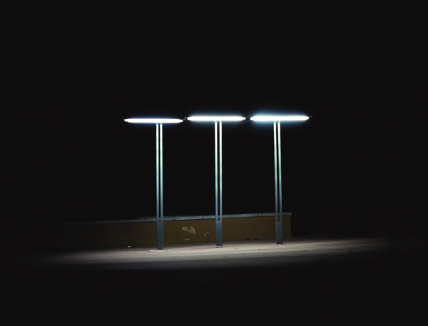
The need to manage, build and occupy space takes us from ancient times to the present, as we modify our environment to suit our needs. The overbuilt city engulfs us, drags us and pushes us. While building this landscape, we have accumulated many places that observed from a distance, and when not in use, are shown to us as strange, even absurd. These spaces, converted into places with no name, and no apparent function, lose the power of what they have been designed for, and build up in every city.


I wonder what these places look like illuminated at night. All are places built for the development of society, for their alleged welfare. Spaces used to move, to direct, to entertain; places all having functions and often necessary for our development as a society. But then what good are they at night? Why are they still working? Why are there so many and why are they there, as if someone had turned on the power to use?

— Llorenç Ugas Dubreuil, Barcelona, Spain
Matthew Evans Golden

www.MatthewEvansGolden.com

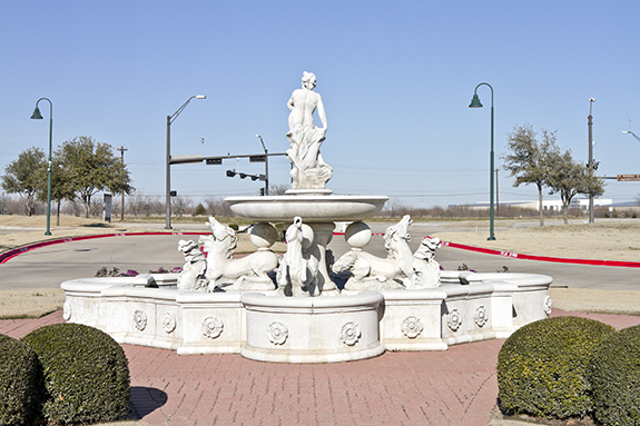
During the course of my photographic career I have been continuously invested in considering the cultural landscape as a mitigating agent for identity. These curiosities grow out of a wide range of experiences; from growing up in suburban Houston, Texas to the time I spent living in Nairobi, Kenya.

This experience of culture shock engaged my sense of place and sparked my affinity for landscape. I have been captivated by the reciprocal and symbiotic relationship between geographic place defining individuals and individuals defining a place.

I am most interested in the geography of sprawl. The methods used to settle the new frontier of virgin land found on the outskirts of existing development mark and give identity to that landscape. These places of perpetual flux are the result of an everlasting desire for the new yet at the same time demonstrate the unfaltering need for contemporary civilizations to tame and control the space of habitation. Most recently I have been committed to making photographs that explore the suburban state of mind through the activities and lifestyle experienced by those of us who dwell there.

Through my photographic practice I am contributing to a greater understanding of the contemporary landscape, culture, and identity by creating images that both describe and inquire about the physical, sociological, and psychological geography of American space. My work reveals moments in time and place that are intimate and public, specific yet universal. I visually expose the space between reality and desire; explore the distance between the future and the present, and position poetic banality within the realm of unfamiliar beauty.

— Matthew Evans Golden, Denton, Texas, USA

Jan Staller

www.JanStaller.net

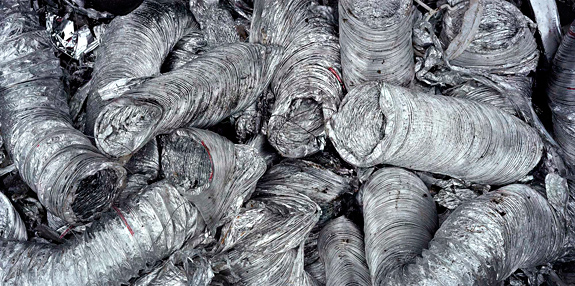
Recently I was introduced to the CEO of a recycling company who welcomed me to visit and photograph a scrap yard that I had long been familiar with, but until that point had unable to gain access to.  Soon after that meeting, I was escorted about a vast terrain strewn with all manner of metal shapes and forms.  Organized by type, scrap metal was gathered in small mountains throughout the site. While the overall landscape was fascinating to look at, I found the clutter distracting.  By taking closer looks within the jumble, I discovered chance arrangements of metal which suggested a kind of gestural intention. A few of these photographs directly reference drawing and others were consciously influenced by Frank Stella’s Bird wall reliefs. Sculptors such as David Smith and John Chamberlain have worked with metal junk and certainly these artists could be seen to have influenced my appreciation for scrap metal.

My photographs of scrap metal are a natural evolution of earlier work where I had looked at construction materials and industrial detritus. In that work my subjects, photographed in the landscape, seemed to take on the qualities of sculpture, earthworks and minimalist art.  Moving my lens closer to the scrap metal meant eliminating the context of the landscape, but in doing so, an order was extracted from the visual chaos.

— Jan Staller, New York City

Zane Davis

www.ZTDavis.com

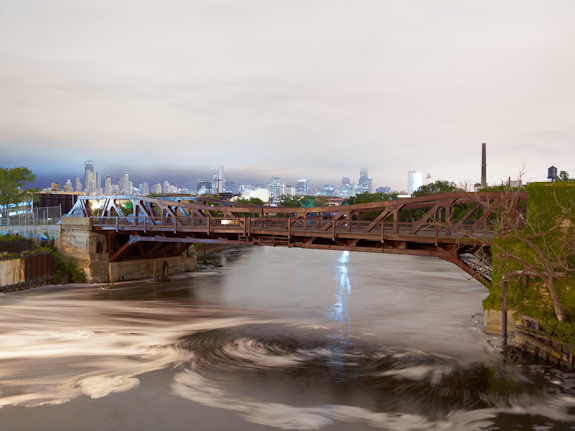
My recent work explores the city as an image of nature tamed with a particular focus on the Chicago River and Chicago’s park system. Very little, if anything, in Chicago can be described as natural at this point, and even that which pretends to represent nature is far removed from its original state: our river has been reversed and many of our lakefront parks are built on century-old landfill. I try to emphasize the artificiality of Chicago’s natural landscapes by shooting only at night, when the light sources are myriad and harder to discern.

— Zane Davis, Chicago, USA

Marion Belanger

www.MarionBelanger.com

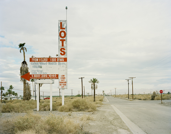
Fault is a photographic study of the western edge of the North American Continental Plate along the San Andreas Fault. The fault runs diagonally from the Salton Sea in southern California, northwest to Cape Mendocino where it then goes back out to the ocean. It is approximately 675 miles long. Earthquake activity, which characterizes the fault zone, is caused by the Pacific Plate sliding north relative to the North American Plate. If this movement continues, in many millions of years Los Angeles will be where San Francisco is now.

Despite the opportunity for dramatic geologic impact, the landscape is often mundane, even striking in its ordinariness. It seems as though the ordered built environment ignores the actuality of the land. I am interested in the visual traces (or not) of the tectonic plate edges as well as in the artifacts of our built environment upon these edges. My pictures show moments of quiet anticipation in settings that shift between the wild and the contained, the fertile and the barren, the geologic and the human. Fault is the second section of a project that will eventually be published in book form as Rift/Fault. Rift pictures the eastern edge of the North American Continental Plate where it meets the Eurasian Plate in Iceland, along the Mid-Atlantic Rift.

— Marion Belanger, Guilford, Connecticut, USA

Andrea Tonellotto

www.AndreaTonellotto.com

I’ve got an idea, a well-defined project. I’ve got really clear instruments and subject to use. A rigorous realization to perform with great care.
 
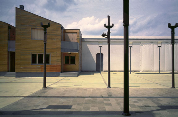
I always research essentiality, structures dedicated to man but without men. Man as designer, his presence as a designer, as a user. You can capture light, often shadows, geometric and abstract shapes and all the contrapositions.
 
I hope to lead my audience through an unreal and abstract world, where the border between reality and vision is very fleeting. Skylight, out of jails, imagination.
 
Cities and factories are closing us in confined spaces. Even though I’ve got no solution, I’d like to decide to stay or run away, to be a prisoner or free, to go to the countryside, to the mountains, to the sea, to open spaces with cleaner hair.

— Andrea Tonellotto, Piazzola sul Brenta, Italy

Fabio Tasca

www.FabioTasca.com

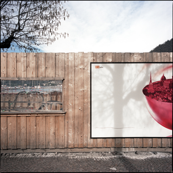
This series is part of a project investigating an old main road, the “Strada Regina” (literally “Queen Road”), which leads along the east coast of Lake Como. It was historically part of a long stretch of road, which, since the Roman age, had brought forth a commercial link through which the Lombard tradesmen maintained business relations with the merchants beyond the Alps.

Today, the “Via Regina SS340” (State Road no. 340) is a traffic-jammed coastal road, which, starting from the city of Como, hits Ponte del Passo (Municipality of Gera Lario), the most northern point of the lake, for a length of about 60 km, following some stretches of the old commercial road and sometimes running parallel to it.

— Fabio Tasca, Como, Italy

Asier Gogortza

www.AsierGogortza.net

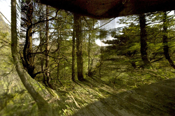
There are thousands and thousands of concrete bunkers scattered throughout the European geography. After more than 60 years, these obsolete bunkers have been gradually assimilated back into the landscape. But still they remain, half-hidden betwixt the valleys and peaks, vigilant, silent witnesses to a dramatic moment in contemporary history.

The bunker is a war construction designed to look, watch and shoot. From the small windows one can capture a specific part of the landscape, honing the visual angle into a target range. Behind the special location of these settlements, which create a complex spider web spanning across the territory, there is an implicit desire to take over the landscape.

Adapting these assumptions to photographic thinking, this project aims to reuse the bunkers with an artistic purpose: to steal their military connotations and transform them into landscape observatories from where the target is “fired upon.”

Pinhole technique has been used to convert bunkers into large concrete cameras and take pictures of the landscapes that were and are target of the bunkers. Thus I intend to carry out both intellectual and aesthetic reappropriation of the landscape.

— Asier Gogortza, Bera, Basque Countries

Lun Cheak & Szeling

www.Szeling.com

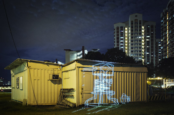
Project Guerrilla Graffiti is a collaborative effort between artist and designer Lun Cheak and photographer Szeling, capturing artwork projected onto public spaces in Singapore.

It’s an endeavor to explore what art would look like in graffiti-scarce Singapore, and considers what if Singapore were more liberal with graffiti art. It is also an exploration of graffiti through a different medium, one that is not illegal.

The artwork is created by Lun Cheak on his iPad, then connected directly to a projector. The duo scout for interesting locations around Singapore where space and art fits.

Upon documenting the projected landscape, Szeling went further with the crafting of the images, injecting a vivid mood to these images that blends the artwork and the environment together, complementing each other as a visual art piece itself.

Lun Cheak & Szeling, Singapore